
|

|
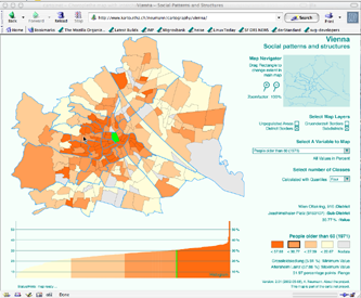
If you click on the screenshot to the left, or on this link you will be referred to an SVG project on its own. The project with the title "Social Patterns of Vienna" combines the graphical possibilities of SVG with enhanced interactivity. One can choose a statistical variable to map and the number of classes to be displayed, using quantile classification method. The user can switch on and off layers, zoom and pan, using a linked reference map. While exploring the map, the name of the chosen sub-district, as well as the chosen variable will be displayed. A linked histogram shows the values relations. When clicking on a subdistrict, a table containing the underlying attribute data is revealed. The table can be moved and folded away. The example was tested in various browsers (Opera, Mozilla, Safari, Internet Explorer, Netscape) on Linux, Windows and Macintosh, using the Adobe SVG viewer 3.x plugin. It does not yet work in Batik or ASV6 (could be easily fixed, but currently I don't have time). |

|
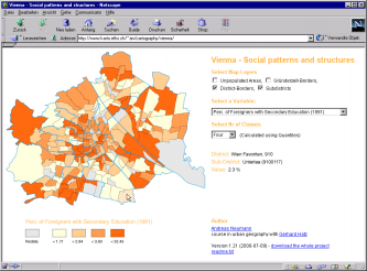
This link leads to the old mixed HTML/SVG version of the project. This version was not updated to contain the newer interactivity features (such as the histogram). Since this version relies on a communication between the SVG plugin and the browser, it only works on Internet Explorer and Netscape 4.7x on Windows, and Netscape 4.7x on Macintosh. |
Example provided by Andreas Neumann
| Last modified:
Tuesday, 10-Dec-2019 21:42:35 CET
© carto:net (andreas neumann & andré m. winter) original URL for reference: https://old.carto.net/papers/svg/samples/wien.shtml |